The walk
Choose to continue the great adventure of the St James of Compostela’s Way by discovering the beautiful Célé’s Valley. This journey will not let you indiferent and will know how to charm you through his landscapes and his patrimony. Times seems to be stopped in this charming valley. One of the key moments of the hike is the stop in one of the most beautiful village of France : Saint-Cirq Lapopie.
Set off on this extraordinary and cosmopolitan route, where conviviality is very strong and the landscapes pass from region to region without monotony! Compostelle, a unique adventure!
Highlights
- An alternative less frequented with beautiful stages
- The village of Saint-Corq-Lapopie
Itinerary
FIGEAC
Arrival to the accomodation late in the afternoon, diner and overnight.
FIGEAC - ESPAGNAC STE EULALIE 23km
The variant of the Camino de Compostela, which passes through the Célé valley, really begins at Béduer. From Figeac, you'll have to continue along the Célé valley on your way to Santiago de Compostela. You'll pass through Corn, once the stronghold of the Cardaillac families, before arriving at Espagnac Sainte Eulalie, a monastery village of steeply-roofed houses. The village (population 70), built around an ancient priory, is home to a strange church topped by a square, half-timbered tower with a pyramidal roof.
Accommodation is available either in Sainte Eulalie, or 3 km further on, in Espagnac (subject to availability).
ST EULALIE - MARCILHAC 18km
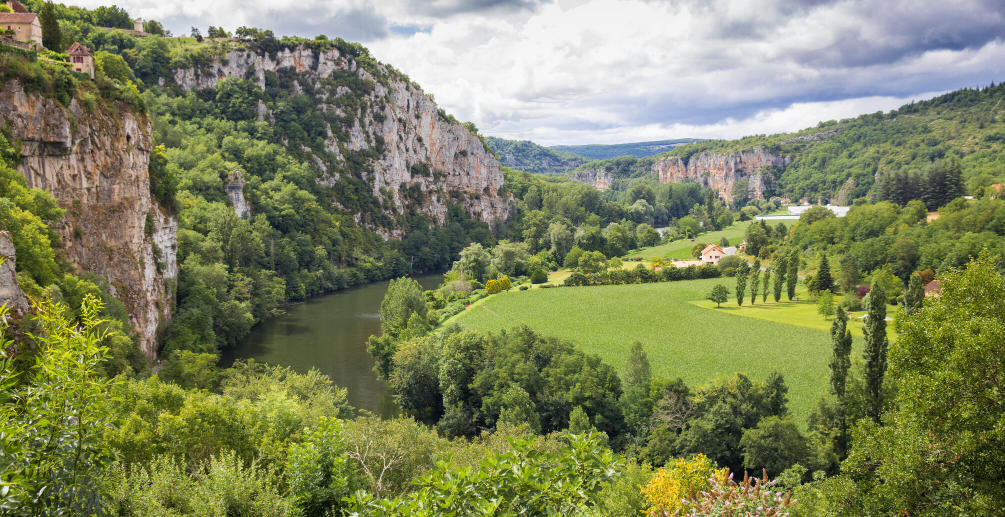
Walk that alternates between the valley and the cliffs and offers a panorama from one bank to the other. You will pass by the Château des Anglais dating from the twelfth century, in the village of Brengues, the castle of Saint Sulpice before descending to Marcilhac surrounded by ocher and white cliffs.
In the heart of the valley, surrounded by high cliffs, Marcilhac has watched over the inhabitants of the region since prehistoric times. The village is organized around its abbey whose Romanesque church has retained all its strength and austere beauty.
MARCILHAC - CABRERET 19km
Hike that takes you to Cabrerets via the Causse and the picturesque village of Sauliac-sur-Célé clinging to the rock, with fortified caves that served as a refuge during the wars. The path in balcony dominates the village and offers a nice panorama on the valley of Célé. In Cabrerets, you can if you wish, visit the Pech Merle Cave, it is home to one of the most beautiful Paleolithic sanctuaries in Europe.
The cave of Pech Merle, discovered in 1922 and opened to the public in 1926, is a vast cavity of almost two kilometers. It has a double appeal: its natural majesty and the beauty of the prehistoric works it contains. It deserves the qualifier of "art gallery in a palace of nature".
CABRERET - ST CIRQ LAPOPIE 11km
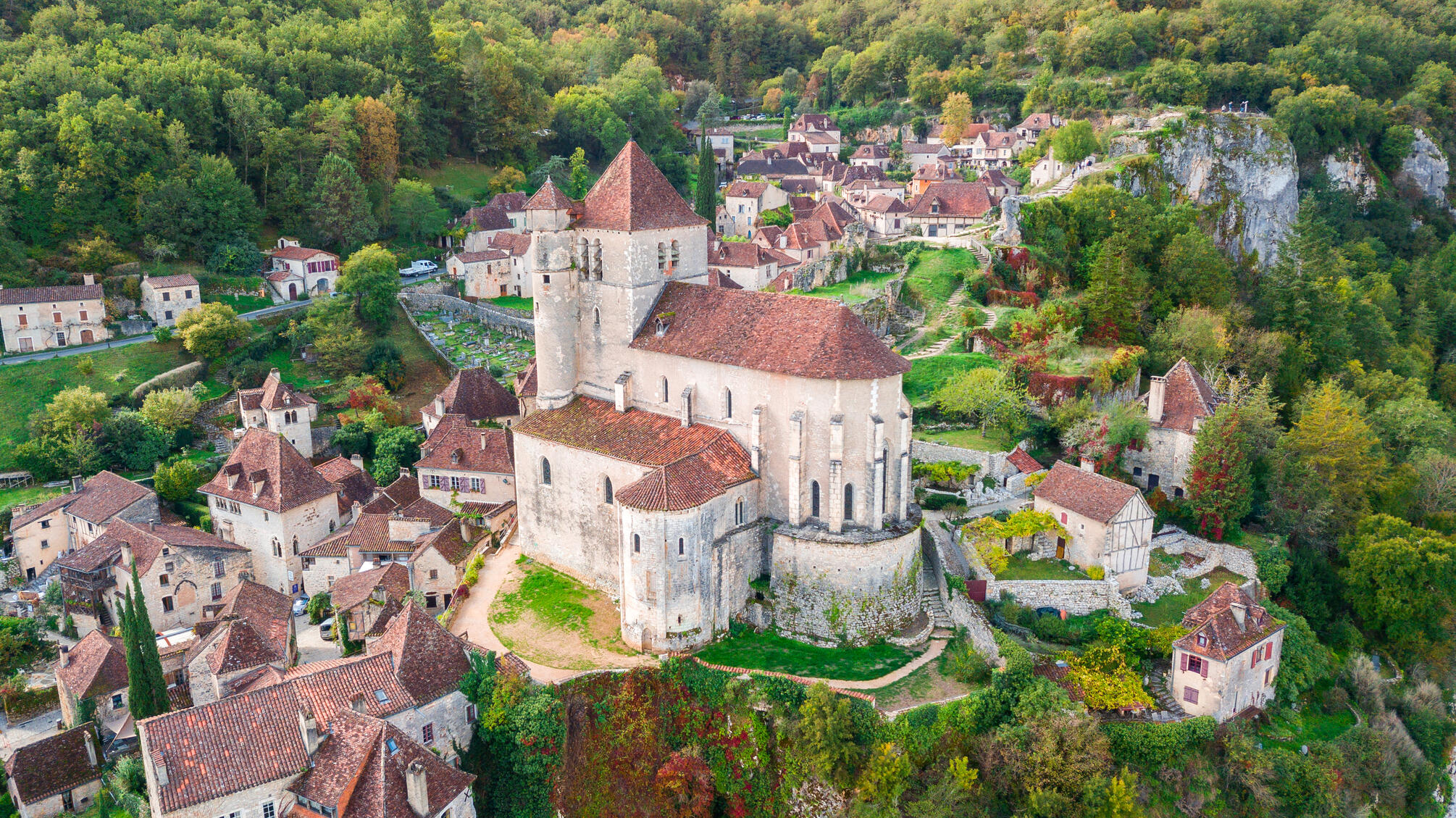
Small day that will allow you to reach Saint Cirq Lapopie by discovering on the heights of Cabrerets the cliffs at the confluence of the Célé and the Lot. Before reaching Saint Cirq, you will pass along the Lot along the old towpath decorated with bas-relief dating from 1989. The village of Saint Cirq is considered one of the most beautiful medieval villages in France. It is located at the top of a rocky peak overlooking the Lot River.
It has retained all its character of medieval fortified village, clinging to the side of the cliff.
ST CIRQ LAPOPIE - VERS 23km
Day of walking on what was once the old towpath. Passing through the heights, you will keep a bird’s eye view of the valley and the river. You will reach your accommodation in Vers by taking a very small part of the GR 46 which connects Rocamadour and which is one of the variants of the way of Saint Jacques.
The village is located at the foot of high limestone cliffs, on a small terrace located at the confluence of two rivers, the Lot and the stream Vers.
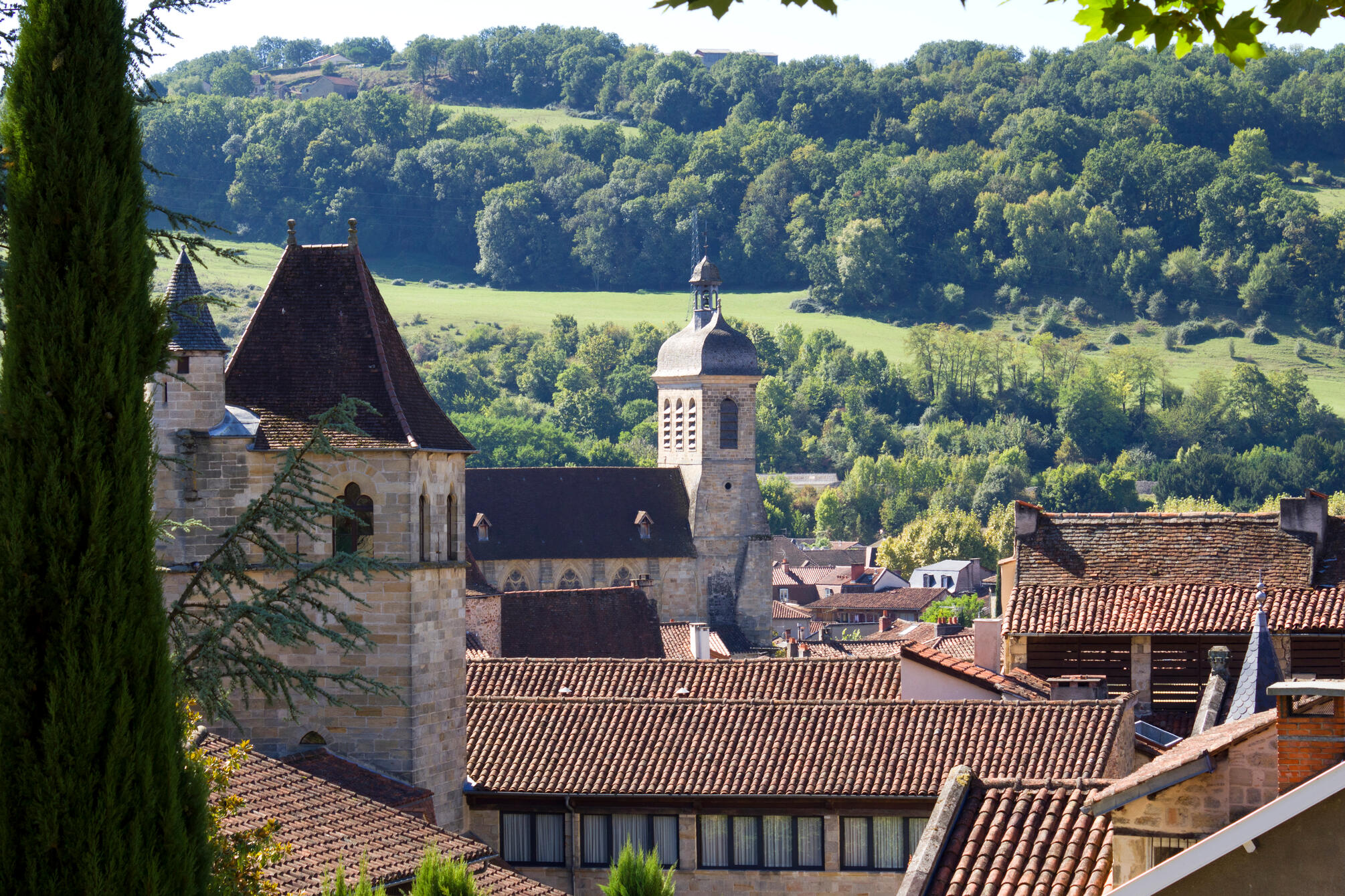
VERS - CAHORS 20km
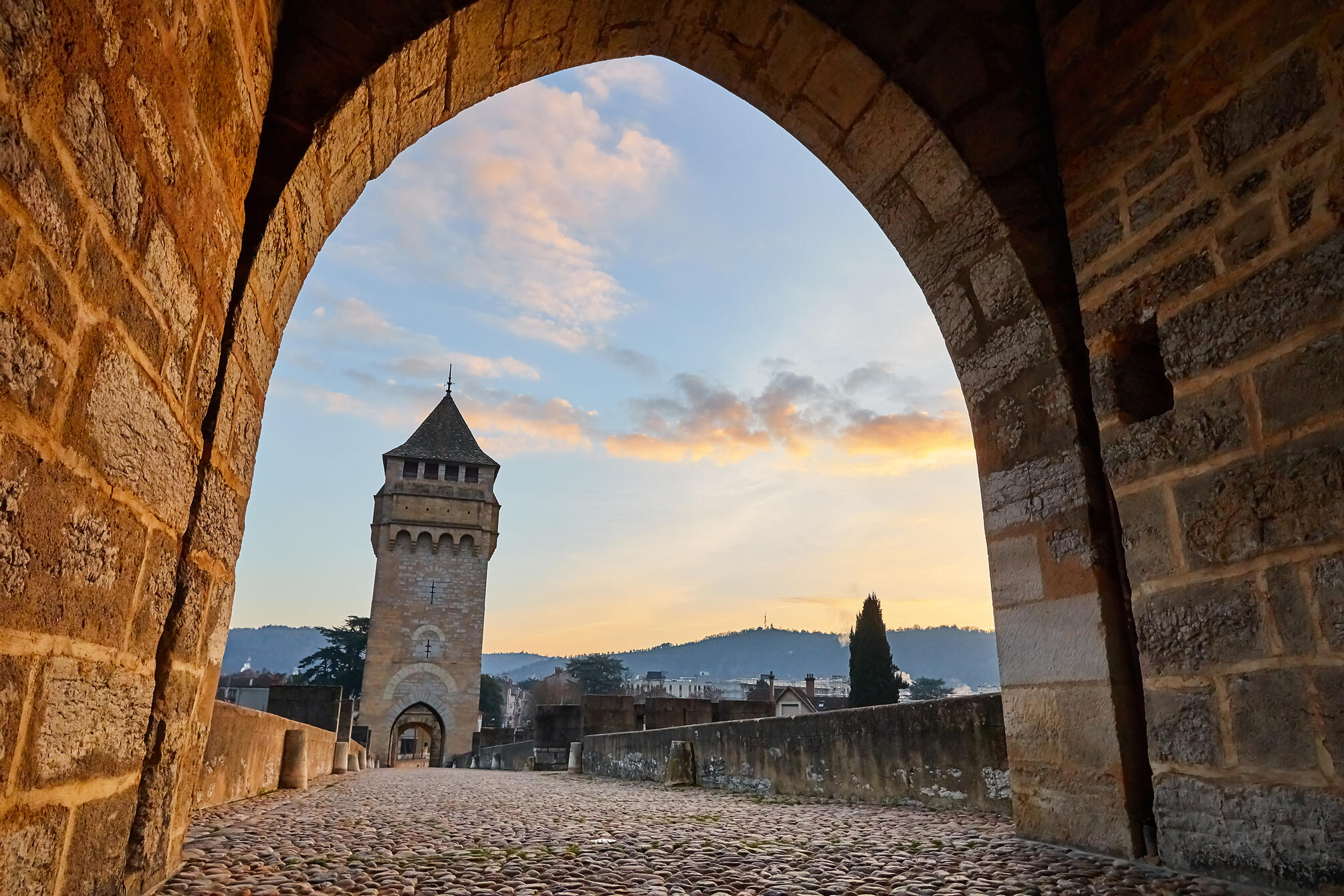
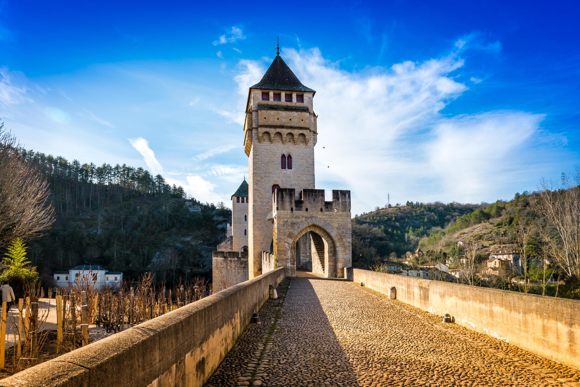
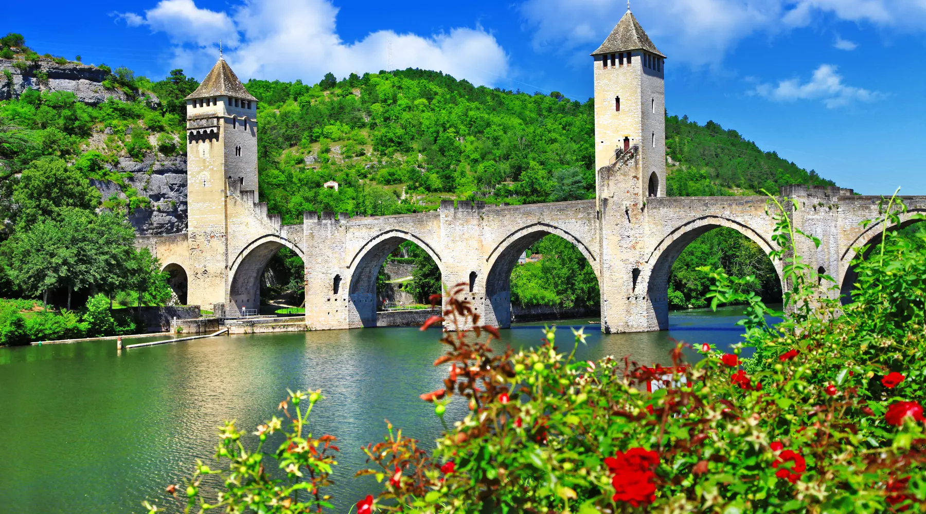
Last day of walk to reach Cahors. You will follow the Lot and, according to your desires, you will have the possibility to join Cahors by passing the GR 36 or by following a variant by the Causse. The symbol of Cahors is the magnificent Pont Valentré, built in the 14th century and a UNESCO World Heritage Site. It is still protected by its three towers of defense.
CAHORS
End of the trip after the breakfast.
Map

Organization
SNCF Railway station of Figeac
- Half board
- Luggage transfer between each walking stage (depending on the option chosen)
- Provision of the topo-guide (1 topo-guide per room reserved).
- Tourist tax
- Picnic lunch
- Insurance, drinks and personal expenses
- Transfers from your home to the meeting point and dispersal
- Registration fees (+15 euros per person), postage abroad (+20 euros per file) and priority processing fees for registrations received by D-15 (+45 euros per file).
- Shuttles or cabs to pick up your car or to shorten certain stages
- Parking fees.
- tourist tax is included in the price.
2** hotels or guest rooms.
Date and price
| Arrival dates | Price pp | Booking |
|---|---|---|
| 01/04/2025 to 31/10/2025 | 920 € | Booking |